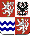
Central Bohemian Region (Středočeský kraj)
 |
 |
The Central Bohemian Region is in the centre of Bohemia. In terms of area, it is the largest region in the Czech Republic, with 11,014 km2, almost 14% of the total area of the country. It surrounds the country's capital, Prague, and borders Liberec Region (in the north), Hradec Králové Region (northeast), Pardubice Region (east), Vysočina Region (southeast), South Bohemian Region (south), Plzeň Region (west) and Ústí nad Labem Region (northwest).
The Central Bohemian Region is divided into 12 districts:
Příbram District is the region's largest district in terms of area (15% of the total region's area), while Prague-West District is the smallest one (5%). In 2019, the region counted in total 1,144 municipalities where of 26 were municipalities with a delegated municipal office. 1,028 municipalities had less than 2,000 inhabitants and they accounted for 41% of the total population of the region. 82 municipalities had a status of town.
Map - Central Bohemian Region (Středočeský kraj)
Map


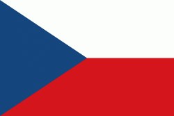
Country - Czech_Republic
 |
 |
| Flag of the Czech Republic | |
The Duchy of Bohemia was founded in the late 9th century under Great Moravia. It was formally recognized as an Imperial State of the Holy Roman Empire in 1002 and became a kingdom in 1198. Following the Battle of Mohács in 1526, the whole Crown of Bohemia was gradually integrated into the Habsburg monarchy. The Protestant Bohemian Revolt led to the Thirty Years' War. After the Battle of White Mountain, the Habsburgs consolidated their rule. With the dissolution of the Holy Empire in 1806, the Crown lands became part of the Austrian Empire.
Currency / Language
| ISO | Currency | Symbol | Significant figures |
|---|---|---|---|
| CZK | Czech koruna | KÄ | 2 |
| ISO | Language |
|---|---|
| CS | Czech language |
| SK | Slovak language |